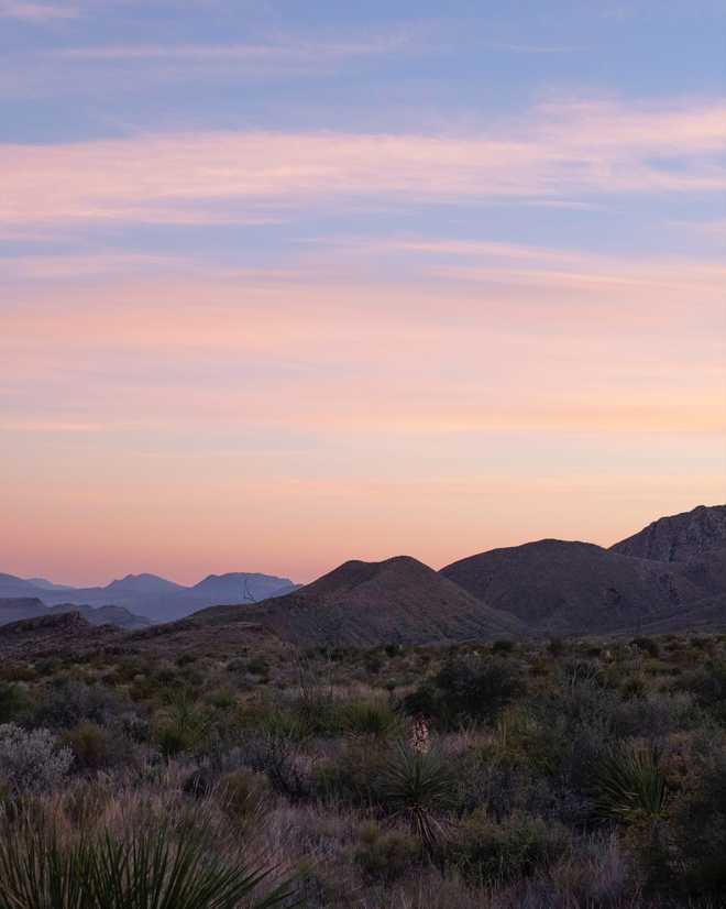
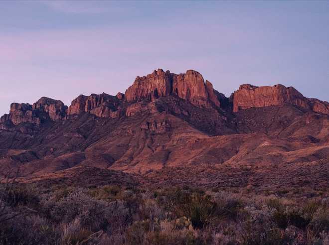
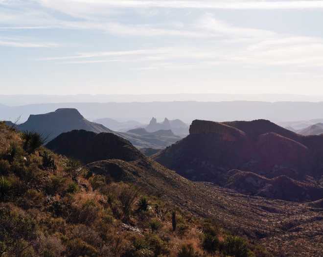
One of my life goals is to visit all of America’s National Parks. Our National Parks offer an incredibly diverse set of landscape. We are so lucky to have these lands and ecosystems preserved in their natural state, I can’t help but feel a responsibility to visit and share what the parks have to offer.
A week ago, I had the opportunity to visit Big Bend National Park. It just so happened that some friends were attending a highly regarded conference happening in Austin and planned to spend three days at Big Bend before the conference. When they asked if I wanted to tag along, there was not a doubt in my mind.
Big Bend lies on the U.S.-Mexico border. At two and a half hours drive away from the nearest town grocery store and about eight hours drive from Austin, Big Bend is not conveniently located.
Considering the significant travel commitment required to visit the park, I figured I wouldn’t have an opportunity to visit again for the foreseeable future.
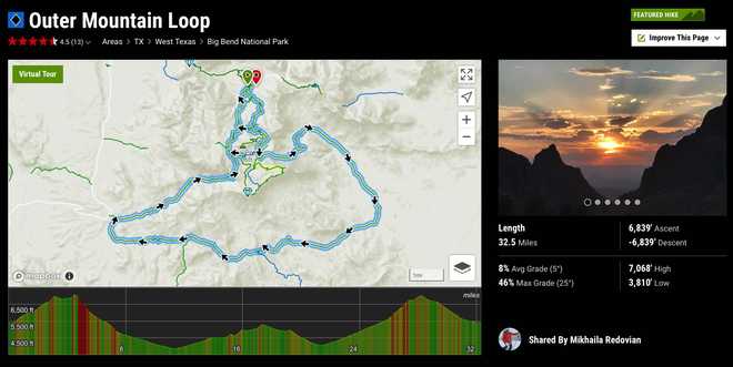
Our plan was to hike the Outer Loop. The approximately 32 mile trip would take our city legs three days to hike. On paper it didn’t appear too strenuous, approximately 10 miles per day, that didn't sound so bad. On top of the distance we would also have to carry enough water to last us for the first two days. The Park Service recommends a gallon a day per person, which meant we’d start the hike with 16.5 pounds of water along with the rest of our camping gear.
Day One
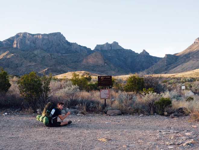
On Sunday morning, we packed up our car camping site and drove to the visitor center to pick up the backcountry permit. By the time we hit the trail it was after 10:00am, which is less than idea when you have to cover eleven miles before darkness sets in around 5:30pm.
The trail did not waist time kicking our butts. With packs weighing heavy on our hips and shoulders, the three mile Pinnacles Trail felt twice as long. We rested leisurely at the the top of the ridge we hiked before continuing on to the Juniper Canyon trail. After completing the additional climb we took a break to enjoy a late lunch.
As we wrapped up, I checked my phone to see how many miles remained. It felt like we'd covered ten miles already! Oh. We still had 6 miles remaining and the time was already 2:30pm. We had hiked less than half way in four and a half hours - only three hours remained before sunset. This realization added a bit of urgency to our pace. Luckily, the trail was all down hill for the until we reached the backcountry sites.
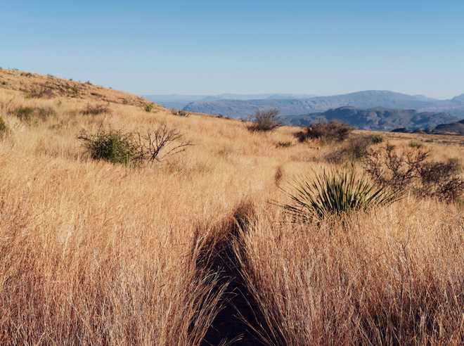
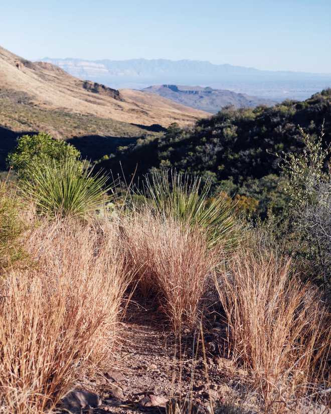
After descending down the other side of the mountain ridge we climbed that morning, we entered a lovely field of golden grass. The sun has dropped low in the sky which lit the field with a warm glow. We stopped to take pictures, but only briefly as we realized the sunny spot we stood in had been swallowed by shadow in minutes. We continued our race with the sun.
In the mountains, days can feel even shorter because the surrounding mountains serve to raise the horizon high above its natural level. Even though it was only 4:30pm, the sun sat only a small ways above the nearby western mountains. Once the sun dropped below the the ridge line we would have about an hour more of light and the temperate would drop very quickly.
As fatigue was beginning to set in, we arrived at the end of the Juniper Canyon Trail, marked by a dirt parking lot. We had completed our planned hiking for the day, but had yet to locate a suitable campsite. After considering pitching our tents in the parking lot, we decided to carry on until we reached the first proper site. Luckily, this was only a few hundred feet further up the trail.
After a wonderful sunset and a re-hydrated meal for dinner, we hit our sleeping pads at 7:30pm. It was dark and we were exhausted. With a alarms set for 7:00am sunrise the next morning we settled in for a much needed twelve hour coma.
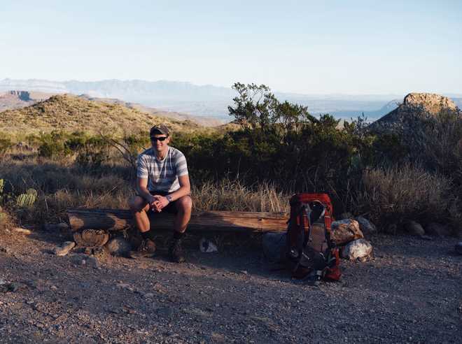
Day Two
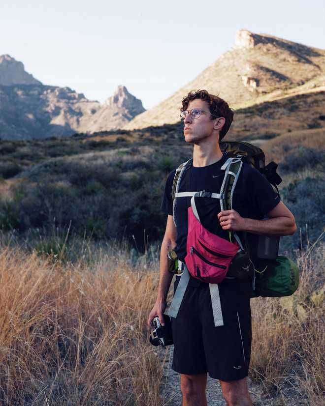
Ring ring. iPhone alarms buzzed us awake at 7:00am. Has it really been eleven hours already? When I went to bed that night, I was worried I would wake in the middle of the night, unable to fall back asleep. The cool morning air nipped my nose while the rest of my body stayed warm inside my sleeping bag. It was hardly light out, surely the sunrise hadn’t started yet I thought to myself while Matt and Jonathan dressed and headed out with cameras in hand.
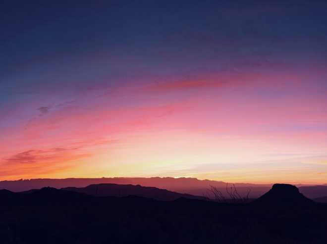
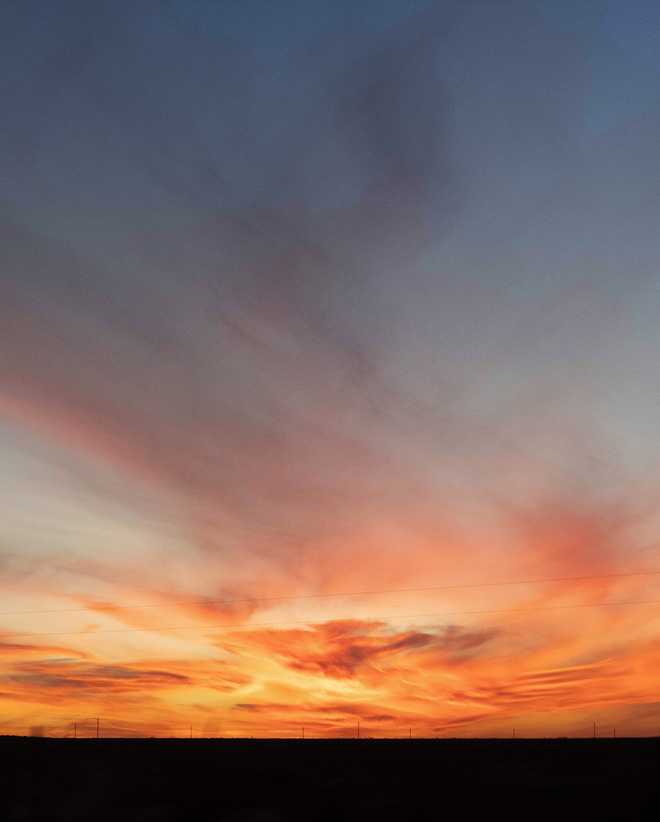
For good measure, I peaked my head out of the tent, wouldn't want to miss a good sunrise. I'm glad that I did, because what I saw took my breath away. The sun, still below horizon, produced the most beautiful sky I’ve ever seen. A vibrant gradient of yellow, orange, pink and dark purple. Quickly, I grabbed my camera and threw warm clothes on. Still dark, it was hard to build a composition with anything other than the sky viewable. With color this vibrant, I suppose that is okay :)
Dazed by the beautiful morning, Matt, Jonathan and I spent the rest of the morning taking photos until the last of the color faded. Afterwards we settled for a relaxing breakfast of Clif Bars, Oatmeal and of course, coffee. By the time we had pack and we ready to leave, it was 10:15am.
“Should be fine,” we told ourselves. Looking at the elevation profile today’s hiking should be much easier than the day before. We started off and quickly became aware that the environment of the day was going to be harsher than the previous day. We had dropped a 1000’ of elevation, enough to change the landscape from dry forest to true desert. There were no trees in sight and no mountain walls to block of the sun. The temperature was only 70º, but after only an hour of hiking we were HOT.
While the landscape profile for the day looked much flatter than the day before, what the approximation had forgone was the constant ascent and decent of the trail. While our overall elevation gain wasn’t much, the endlessly rising hills became a mental and physical struggle. When we’d reach the top of one hill, we’d see another ahead higher, but first requiring a decent almost as far down as the hill we had just climbed. Day Two was proving to be more strenuous than expected.
It seemed that in the desert every single plant is armed with defensive spikes. Even the friendliest bushes would grab and scrape our exposed legs as we brushed through them. The pain was annoying, producing internal screams every few steps. We contemplated changing into long pants, but the thought of wearing full pants in this heat seemed unbearable; so we continued on, legs reddening as we labored on.
Unable to find a shade for lunch, we parked it on top of a hill. Refueled we put our heads down and climbed the last few large hills before the the trail would tilt to a net downhill. A few hours later, as we breached the top of a large hill we were greeted with an unexpected panoramic view. It was grand and inspiring. This is what a National Park should look like, I remember thinking to myself. A rather [lame] comment I admit, I was a bit grumpy from our long desert slog.
A view the viewpoint certainly deserved a photo, even in the harsh afternoon light, and besides it marked an accomplishment. The trail appeared all downhill from here. I dropped my pack from my shoulders and went to grab my camera - but it wasn’t there!
Anxiety began to creep into my mind. Had I left it at the lunch location? That was two hours back. We had stopped about a mile back for water, but I couldn’t remember if I’d had a reason to open my pack. One of the benefits of hiking with engineers is that they’re extremely good at emergency response planning. Immediately Matt and Jonathan mapped out all the possible situations and what the response would be to each. We decided that Matt would stay at the current location and look after our bags while Jonathan and I ran back a mile to our last stopping point. Regardless of whether the camera was there or not, we’d have to return to the viewpoint and continue on. Because of our late start, our chances of setting up camp before dark were already slim.
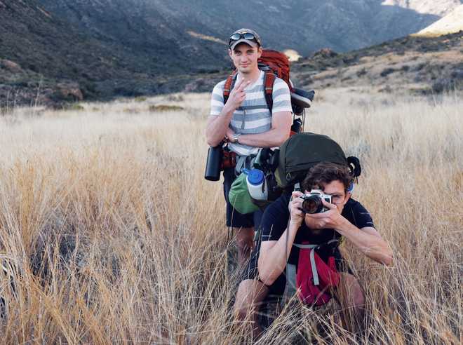
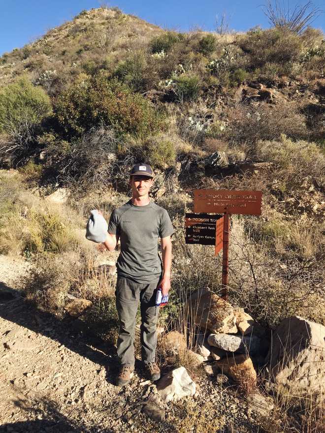
As we ran back, the anxiety began to leave me. I haven’t ran in a while, I’d forgotten its therapeutic nature. As my mind cleared, I became more and more confident that the camera would be at our resting stop. By the time we rounded the last corner, I was certain it would be lying on the ground, wrapped in my winter hat for protection. Sure enough, it was. Jonathan made me pose for a photo.
By the time we reached Matt we were adequately behind schedule. It was almost 4:30, an hour before sunset, and we had a solid 4-5 miles to go. Time to haul. Into the valley we descended. Because we had cached water near this area, we had our bearings enough to realize we need to make it to the other side of a butte that looked impossibly far away. How could we cover that distance in only an hour? Best not to think about it too hard, I figured.
We made good time, and before long we had made it much further than expected. The Wilson Homer Ranch house appeared as if from thin air. We had essentially complete our second day. After picking up our cached water, we stumbled a little further up the trail in limited light until we arrived at the first campsite. After a Chilly Mac and Beef dinner, we tucked in for another early night.
Day Three
The next morning we were determined to get an earlier start. We ate breakfast, packed up and were on our way by 8:40am - one and a half hours earlier than the previous morning! Looking at the elevation profile, it appeared that we would be doubling the previous day’s elevation gain. I think this left us all with a bit of concern. The previous day had been very difficult, we weren’t sure how we’d fair with an even more demanding day.
The trail began up a winding, dried out river bed. We wound between orange canyon walls that reminded me of the famous orange rock in Utah that looks to have been transported from Mars.
The riverbed worked its way up a valley. Large mountain ridges loomed high on either side of us providing shade. We hiked on through the riverbed for about two hours until the trail was left with no where else to go besides up and over the mountain ridge. We had stopped for water a few times, but ultimately were making very good time. I checked the elevation profile and was surprised that we had already knocked out half of the climbing for the day!
As we began up the ridge, the sun was high in the sky, rising over the southern mountain ridge which had graciously protected us through the morning. The pitch of the trail changed from moderate to taxing and our progress slowed. At this point, we were comfortable with our timeliness and more than happy to take breaks to look back on the beautiful canyon as we climbed up the steep hillside. It was becoming clear that soon we would breach the ridge and in doing so return to the populous side of the park. We hadn’t seen other people all day, and didn't really mind.
Reaching the top of the ridge was a less climactic than anticipated. The higher elevation of the mountaintop was covered with trees which blocked our any view. We opted to continue on before breaking out for a lunch picnic.
It didn't take long before we descended on a clearing with a wide open view of the Visitor Center we had departed from three days prior. We were all smiles as we reached the viewpoint. We each found a suitable rock bench and giddily broke gorged on a last meal of nuts, dried fruit and almond butter packets.
As we packed to leave, a woman walking past on the trail greeted with an enthusiastic, Hello! She asked what route we had hiked, and with a bit of pride we responded that we were on the verge of completing the Outer Loop.
"Wonderful!", she replied. "I'm planning to do the Outer Loop tomorrow."
Tomorrow... Did she mean that she would be completing the entire 31 mile trail which we had struggled on for the last three days in just a single day. Yes, that is exactly what she meant. Full of energy, she explained that she was volunteer at the park and loved to get out and hike as much as should could. In fact, on her hike this morning she found herself in a staring contest with a mountain lion perched in a tree near the edge of the trail. I don't know that I've ever met another person with so much zest for life. Oh, and I almost forgot, she is 70 years. As we exchanged names and parted ways there was only one thought left in my head, what a boss.
The rest of our day was uneventful. We completed the remaining downhill three miles with relative easy. At the visitor center we contemplated our options for that night. Should we find a place to stay in Fort Stockton (2 1/2 hours away) or saddle up and haul all the way back to Austin (about 8 hours drive). Our minds was made up for when all of the hotels in Fort Stockton were either booked or charging extremely high rates due to the oil workers currently staying in town. We stopped for dinner at a wonderful Mexican dinner spot and then continued on to Austin. ETA 1:00am.
